About the ecotrail
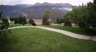
The Blueberry Ecotrail boasts a diverse landscape and sweeping panoramic views. Along the route, colorful flower meadows give way to forest communities featuring centuries-old trees: firs, maples, and beeches.
Here you can observe the ripening berries of common blueberries in the alpine meadows, while the spreading, tall Caucasian blueberry bushes grow in the forest. Their fruits provide food for numerous inhabitants.
The route begins at Cirque-1, ascends to the ridge of Mount Aibga at an altitude of 2,200 meters above sea level, and from there descends to the Mzymta River. To plan a trip along the Blueberry Ecotrail, contact the «What to do» Bureau. Experienced guides will share valuable tips, help you pack for the hike, and accompany you on your journey.
Highlights of the route:
- panoramic views
- patriarchal trees
- plants endemic to the Western Caucasus
- mountain streams
When planning your route, we recommend considering your health and objectively assessing your physical capabilities.
What to take with you
Clothes
Sneakers or light trekking shoes, breathable T-shirt, fleece, hat for protection from the sun
Backpack or bag
1.5 liters of water, snack, sunscreen SPF 30+
On the phone
Krasnaya Polyana app and offline route map
Not necessary, but worth it
Trekking poles for the descent, binoculars, thermos with tea